One of our adventures in Valdez is to take a helicopter up to the glacier snow field, check out the icebergs on the Columbia Glacier ‘shore’, fly around the glacier and then back to the airport. We checked the radar and the NOAA weather reports - UGH, the weather is not pretty. Rain clouds, fog, drizzle. You name it, we are going to get wet weather. We had originally scheduled a flight for next Monday since that looked the best, but that forecast changed and the weather looked even worse than today so we headed over to the airport to see what they might recommend. Should we have done this on our last day in Seward when it was sunny? Absolutely. But, it is what it is and we got a day that was not sunny and where the cloud cover was low. He had an opening for today, we headed home for a small lunch, a change of clothes and we were back at the airport and in the helicopter for our first helicopter ride.
Here we are, taking off. We were up and away, over the airport.
Gary has a GPS program which traces where we go and, when we got back, he placed our trip over the actual terrain map. Thus, here is our flight. You can see where the pilot tried 3 times to get us up to the ice field at the top of the glaciers. But, rain hit us every time.

You can see where we flew across the face of the Columbia Glacier on the left of the picture several times and across the face of Shoup Glacier closer to the town.
We flew over the Columbia Glacier, one of the largest near Valdez but which is shrinking the fastest. The Columbia Glacier was first documented in 1794 when it appeared to be stable with a length of 41 miles. During the 1980s it began a rapid retreat and by 1995 it was only about 36 miles long. By late 2000 it was about 34 miles long. The loss of a massive area of the Columbia Glacier’s tongue has generated a tremendous number of icebergs since the 1980s and the Exxon Valdez ran aground while avoiding a Columbia Glacier iceberg in 1989. Columbia Glacier began rapidly losing ice during the early 1980s. Since that time, the glacier has retreated more than 10.5 miles and lost 50 percent of its volume, mostly due to calving. As of 2015, the ice lost is estimated to be equivalent to 28 to 36 cubic miles of water.
There are several cruise boats that head out to Columbia Glacier every day but the icebergs that calve off of the glacier can be twice as big as the boats so these boats seldom go closer than a mile.
Here are Landsat satellite images of the Glacier from 1986 and 2014 showing how much it has shrunk.
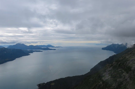
We flew out over the glassy seas of the harbor.

If you look closely off to the upper left, you can see a flat island with a short round knob in the middle - looks like a hat. Well, that’s the island that the Exxon Valdez ran aground on.
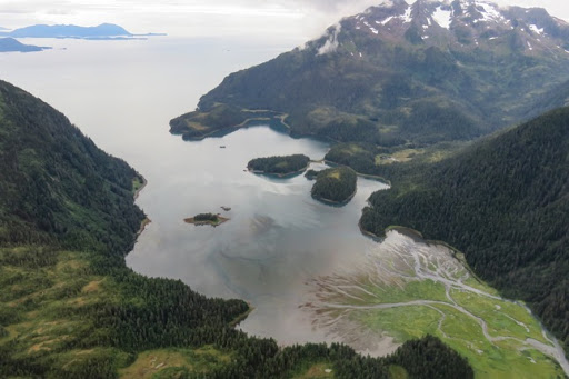
We found this ice dammed lake high up.
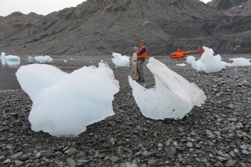
We landed on a ‘beach’ about 2 miles from the terminus of the glacier.

Just for comparison, here is the picture of our friends on the same flightseeing tour last year.
We were intrigued by the icebergs.
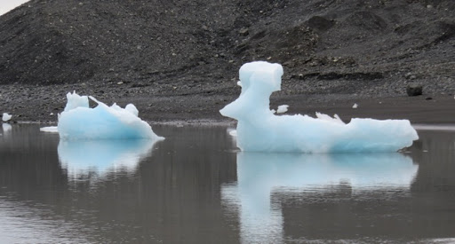
I thought this one looked like a chicken.

Here’s the edge of the glacier. It’s about 200’ tall. We could hear it calve but the sound comes after the fact so never got a picture of one.
Look at those wrinkles in the glacier (the crevasses) - almost as many as I have.
Here are some seals resting on icebergs - chunks that hve broken off. You can see why tour boats don’t get too close to the face of the glacier with all this ice in the water.
I’ll have trouble publishing this blog if I write any more here so am putting the rest of our flight into another blog.


No comments:
Post a Comment