
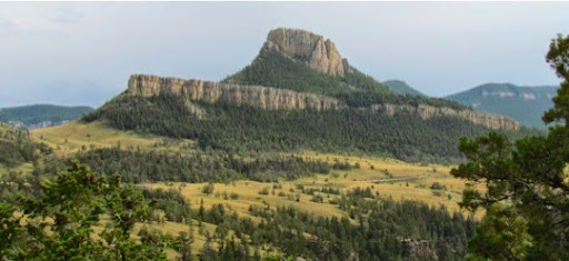
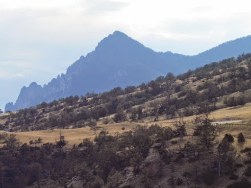
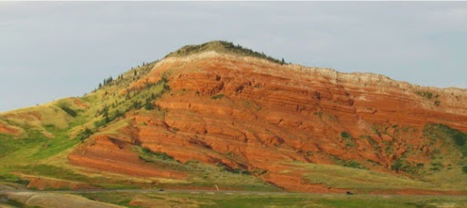
After we had descended from the Beartooth Range and were on more level ground, we turned south on Rte 276, the Chief Joseph Highway. This is not the high elevation drive that the Beartooth is, crossing its pass at 8060’ but it more scenic, passing through wide open valleys dotted with ranches and surrounded by tall forested mountains. However, the builders of the road didn’t find a curve that they didn’t want to take, a mountain they didn’t want to ascend and then descend nor a straight line they wanted to follow. The whole road is beautiful with the golden colors of the hay blowing in the sun matched by the green of the surrounding pines. It’s 47 miles and takes 2 hours to drive - if you don’t stop to take pictures and admire the scenery. I know it took us much longer than 2 hours.
The Sunlight Creek Bridge and the Dead Indian Summit, two of the major attractions on this highway, are a long ways down the road and we’re just driving along reveling in the marvelous views, stopping at regular intervals to get out of the Jeep to take closer looks. So, while we’re rambling along, I thought I’d say a bit about Chief Joseph, after whom the road is named. He lived from 1840 to 1904.
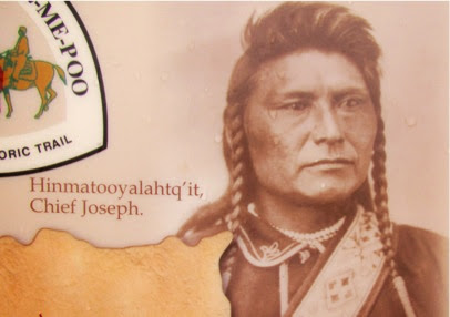
The story is an old one, often told: The government of the US negotiated a treaty with the Native Americans ceding them land and then realizing that gold is on that land or that homesteaders are ready to farm that land or that ranchers need more land for their cattle, the government wants to renegotiate for a much smaller tract, further away and of dubious value. The same thing happened to the Nez Perce, Chief Joseph’s tribe.
The original treaty in 1855 established a Nez Perce reservation of 7.7 million acres in present-day Oregon, Idaho and Washington including much of their traditional land. Then gold was discovered on that land and the government in 1863 wanted to renegotiate the treaty so that the Nez Perce would have only 760,000 acres, one tenth of what they had in the original treaty and NOT including their traditional lands. Some of the Nez Perce accepted this new treaty but not Chief Joseph and about 1000 of his tribe who then led the army on a 3-month 1170-mile circuitous chase through Yellowstone and northern Montana trying to get to Canada to join up with Sitting Bull who had fled there in 1876 after the Battle of the Little Big Horn. But it was winter, he had many elders, women and children in his group, their food was running low and finally he surrendered less than 40 miles from the border.
150 of his followers had been killed or wounded and the rest, along with Chief Joseph, were herded into unheated boxcars on a train bound for a POW campsite in Kansas and eventually to a reservation in Oklahoma where many died of disease and heartbreak. Chief Joseph is famous for his stand for his people’s traditional ways and lands, his leadership, his fighting tactics and strategy and also for his surrender speech ending with these lines:
‘ Hear me, my chiefs, I am tired: my heart is sick and sad. From where the sun now stands, I will fight no more forever.’
Chief Joseph
Sad, story that happened way too often in our past. Interestingly, we’re heading over to the little Big Horn Battlefield NM next for another chapter in that same story.
The Chief Joseph Scenic Highway follows part of the route that Chief Joseph and his tribe followed through this territory on their way to Canada. And, scenic it certainly is.
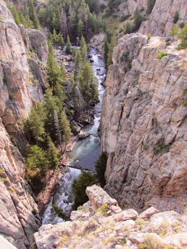
One of the main attractions, after the scenery is Sunlight Bridge, said to have the smallest ratio of span to depth: it is very short and the river below is a long way down, 300’ in fact. We came around a bend and there it was.
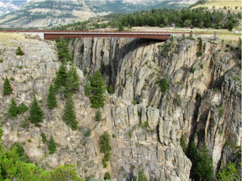
Luckily, there was a parking lot on the other side that we could park in to spend more time admiring this neat bridge.
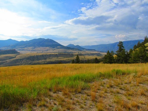
A second main attraction is the Dead Indian Pass at 8060’ just before you wend your way down to the valley below where Cody is.
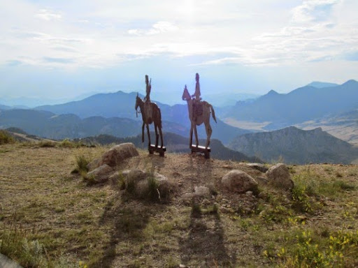
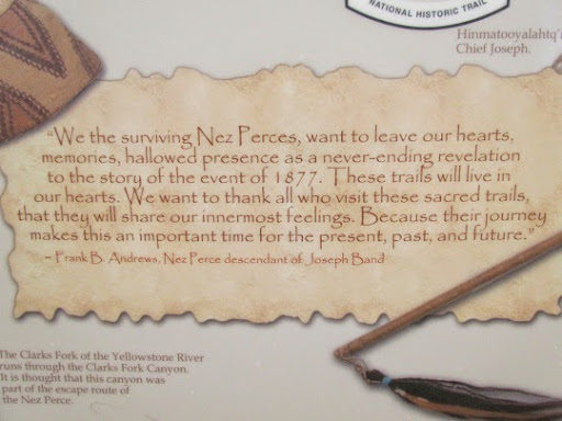
Here they have built a neat overlook along with various posters documenting Chief Joseph and his journey through this area. This is where it is thought Chief Joseph led his people out of this valley and away from the US Army. When they got here, they thought that they might be able to escape from the army close on its heels. In the pass, they left a wounded warrior who was eventually discovered and killed by the Army scouts. Thus, the name of the pass is ‘Dead Indian Pass.’
Finally, after driving the Beartooth Highway and the Chief Joseph, we are heading back to the RV but the road still has some beautiful views for us as we head home.
It’s 8:00 before we arrive and as Gary unpacks the car, I make dinner. I’ve gotten used to making dinner fast since we’ve often get back to the RV late after a long day. Just call me the ‘Queen of the 10-minute Meal.’
No comments:
Post a Comment