
Serendipity today. When we were in Yellowstone, we realized that we just would not have time to drive the Beartooth Highway and we postponed it to when we were in Cody. Today, we’re in Cody and drove the Beartooth Hwy BUT also, because we were in Cody, we made a loop and took the Chief Joseph Hwy back to Cody. What luck. Had we driven the Beartooth from Yellowstone we would not have driven the Chief Joseph and it was by far the most beautiful of the two roads. Sometimes, we’re just lucky.
‘The most beautiful roadway in America.’
Charles Kurault
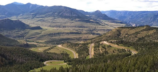
That is how Charles Kurault described the Beartooth. If only I could say that the photo below was my picture - it is not, it is from the Red Lodge, MT website but I wanted to use it because it shows how the Beartooth snakes up the mountainside and curls in on itself several times.
I’ve heard about the Beartooth highway for years and always planned to drive it but never knew the history of its being built. Why would someone want to build a highway as difficult as this through terrain as mountainous as this? Well, how about those mine owners in Cooke City and Red Lodge who wanted to move their ores through Yellowstone to market on the west coast? And how about those tourists who wanted to get into Yellowstone to visit? And how about those Montana and Wyoming politicians who wanted the road through their states and the federal money to pay their workers to build it? Hmmm.
Probably, moving ores through Yellowstone is a non-starter but, with the advent of the car, tourists wanted a convenient way to get into the park and a road through the Beartooth would be it. All projects this large need a visionary, someone who sees the future, how to get there and is persistent. In this case it was J.C.F. ‘Doc’ Siegfriedt who moved the project along. He lobbied the US Congress for 6 years, from 1925 - 1931, supported by the people of Red Lodge who ponied up $2500 every one of those 6 years to send him to Washington. It was the Depression, one of the two mines in Red Lodge had gone broke but they still found the money to get him to Washington to lobby. Each year he went and each year he convinced another Congressman. Finally in 1931, President Hoover signed the Park Approach Act and the road was started in 1931. Other approaches to other parks were included in this bill but only the Beartooth Highway was started in this time frame.
Difficult to build? Heck, yes. The terrain was horrendous, the construction season was short, the weather was harsh, it was the beginning of the depression but they got it done on time and within budget. Steep slopes, long drop-offs, hard granite mountains all had to be overcome and the construction engineers designed it extrordinarily well and the workers worked hard - with only one death. The highway was officially opened on June 14, 1936 and a caravan of cars took their turn curving the road and marveling at its beauty.
The workers had a great time naming some of the points of interest: ‘Primal Point’, ‘Lunch Meadow’, ‘High Lonesome Ridge’, ‘Grizzly Knob’, ‘Frozen Man’s Curve’, and finally - ‘Mae West Curve’, a curve that doubles back on itself. I kept looking for signs pointing out these points but these names have been lost in the ensuing years.
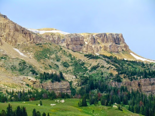
The Beartooth is a thrilling curvy ride to the top of the Beartooth Mts, starting in the dry desert landscape of northern Wyoming and ending in the alpine tundra in Montana at the top. Somehow about 50 million years ago, this rock heaved itself upwards and then an enormous glacier melted, retreated and carved the canyons into beautiful U-shaped valleys. Got that? heaving, melting, retreating and carving - geologists are marvelous, able to read the rocks to tell all of this. I look at a rock and can tell immediately: this is hard. That’s about as far as I go.
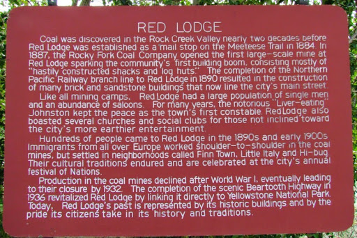
We started in Cody drove north to Belfry, turned west on rte 308 and drove by an old abandoned mine. But it was not abandoned because the vein ran out - no, it was abandoned because there was a horrific disaster and 74 men died, fifty-eight women lost their husbands and 125 children became fatherless, including six of eight students in the senior class at Bearcreek High School.
‘Good-bye wives and daughters. We died an easy death. Love from both of us. Be good.’
Walter & Johnny
It was a sunny Saturday morning, February 27, 1943 and only a short shift was working in the Smith mine between Belfry and Red Lodge, MT, two towns built on coal mining. 77 men entered the mine, only 3, those near the entrance, would come out alive. They did not even hear the explosion, all they knew was that debris was flying out at them and they were blown over from the wind coming from deep in the mine. The rescue went on for two days as body after body was brought out of the mine. 8 days later the final body was brought up to the surface.
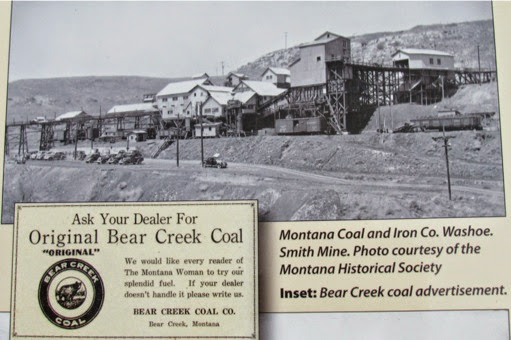
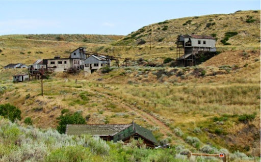
Ore was extremely profitable in this neck of the woods in the early part of this century. There were coal mines all over these hills. One of them, the Smith mine, spent thousands electrifying and mechanizing their mine but very little on safety equipment for the miners. In fact, they were still using open flame carbide headlamps even after safer electrical lamps had been invented. Ventilation? Rock dusting equipment to keep the mines free of dust? Nope, none of that. And, guess what, after they closed this mine because of the deaths, they kept their other mines opened and earned a record profit. And, of course, we still hear stories of men trapped in mines, stories of a lack of safety equipment and stories of familes left fatherless.
When we hit Red Lodge, we stopped for a soda in the local grocery, read the local signs written by someone with a wry sense of humor.
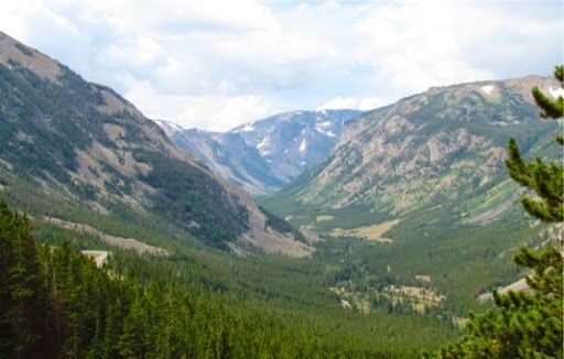
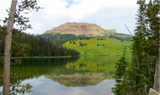
and then headed towards the Beartooth Mountains. Nice drive alongside the river but then the valley opens and we see the Beartooth Range looming ahead of us.
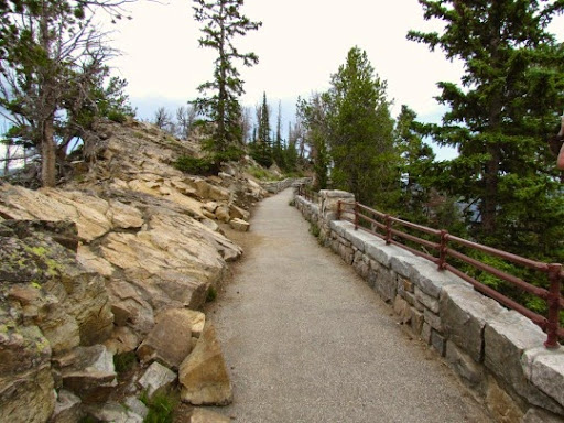
We climbed and climbed upward in tight switchbacks until we reached the Vista Point Scenic Overlook (with bathrooms - if you can believe that - obviously this road was built for tourists) and stopped to look out over the road we had just climbed.
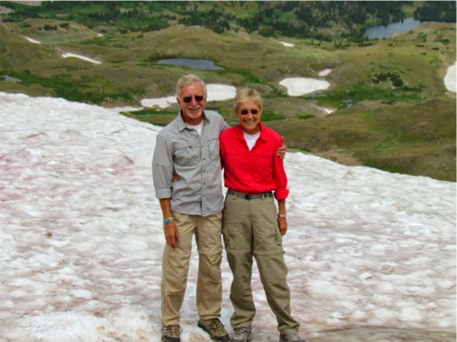
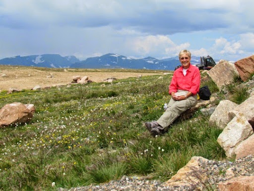
Can you think of a more wondrous spot for lunch?
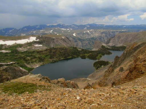
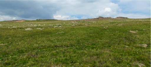
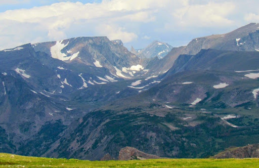
Further up, the trees end and an alpine tundra takes over: just grasses, small wild-flowers and rocks. and the views all the way up are marvelous. We stopped at the top (near the skiing tow rope - yep, there is a tow bar at the top - you drive to the top if the road is open, park and ski straight down, then take the tow rope up for another run.) At the top we had lunch in the sun and alpine wildflowers. We had climbed up to 10,947’, the highest elevation in any road in Montana and Wyoming and the highest elevation road in the Northern Rockies. Was I having trouble breathing? You bet, it’s a ‘breathtaking’ drive but every minute or so I had to take a deep breath to catch up. Then, of course, you get to wind your way back down the Beartooth, with every turn bringing another breathtaking view. Hey, we even saw the ‘beartooth’ that the range is named for. That tiny pointy thing between the looming mountains.
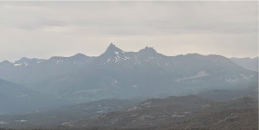
We also saw two singular peaks: Index and Pilot. Jagged and what a pair, indicative of the jagged Beartooth Range.
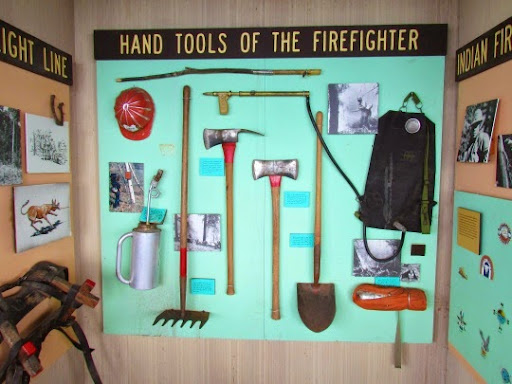
On the way down is a fire lookout with the ‘Welcome’ sign out and we drove up the dirt road to the top. It is a climb in itself but we saw the most marvelous wildflower fields possible. Beautiful. At the top we looked through the small museum devoted to telling about fire fighters in this area.
Then we talked with the couple who is volunteering for this 2-week span of living in the tower and looking for fires. Anyone can volunteer, the tours of duty are 2 weeks unless you want more and there is a comfy little space for you to live in the look-out tower. You work 5 days on, get 2 days off, work 5 days and then you can leave for the next people who volunteer. I’m still trying to convince Gary that this might be a fun thing to do. He’s not so convinced.
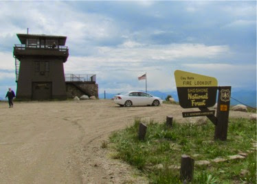
While we were in the tower, another group of 3 came up - from Ottumwa, IA. 5 visitors in the tower and we’re all from Iowa - and, the 6th person in the tower, the volunteer, had ridden Ragbrai. Wow.
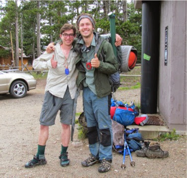
On the way down, we found these two guys hitching down the hill. Calvin and Tom had been backpacking and camping for the last 4 days - all of them rainy. Were they glum? Not a chance. They had had a great time out in the wet woods and were still smiling - though everything they had was wet and muddy and so were they. They had come from Red Lodge and had been in the Beartooth Wilderness for the last 4 nights. We decided to give them a ride and, luckily they had a tarp they could put over our stuff and under theirs. When we got to the bottom of the hill, we didn’t just want to drop them off there so we drove back to the Top of the World convenience store/gas station/bathroom/bakery/book store etc.
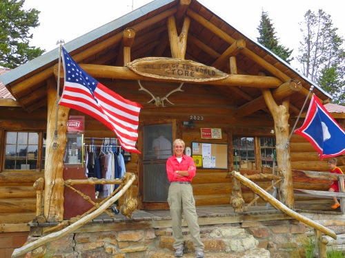
Here they could us the bathrooms and probably find a ride back to Red Lodge. Look at the boots off to the right - Tom changed into his camp sandals before he got into the car. He must have known how prissy I was.
We then turned back, drove by the Lookout tower road again and wound our way down the road towards the Chief Joseph Highway which would take us back to Cody. But, I’m thinking another picture or two of the sights along the Beartooth wouldn’t hurt.
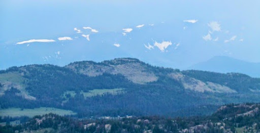
Those white spots above the mountains are not clouds but mountains in the next range. We did not have a sunny day for most of our trip over the Beartooth. I would have like the sun for the pictures but the haze and clouds resulted in some other views.
Finally, we reached our turnoff on the of the Beartooth, turned south onto the Chief Joseph Scenic Drive back towards Cody. Little did we know what a marvelous drive it would be and how stunningly beautiful it would turn out to be. The Beartooth is a thrill ride to the top of the Beartooth Range but what the Chief Joseph lacks in height, it more than makes up for in beauty.
No comments:
Post a Comment