
We left Seattle in the morning heading north to the road which will take us over the North Cascades. We needed propane, gas and - donuts. We checked Gas Buddy for some diesel stations and found one right off the road. As we were pulling into the parking lot, we stopped and took a look. Not a bustling station, needed some paint, the sign was coming apart and I’m not sure we want to stop here. We like to stop at busy stations so we know that the diesel is turned over a lot. This did not look like one of those. As we were talking it over, a truck drove towards us, really towards us. I noticed that the truck driver was wearing a pink shirt. Cute. Sure enough, the truck driver, a woman, stopped, told us not to go here but to go to a station further up the road. She said she would tell her parents, who drove an RV, not to go here, terribly pot-holed and rutted, the parking lot would tear our suspension out. Thanks, and we took her advice.
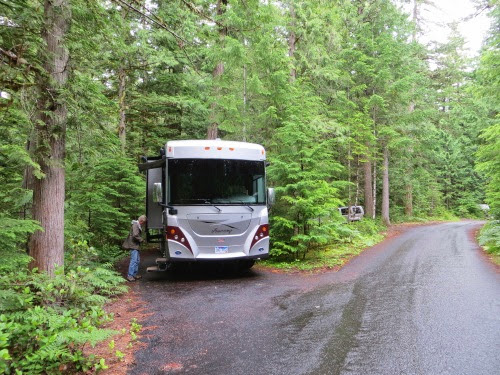
The other station had a nice smooth parking lot, clean bathrooms, fresh donuts, cheap propane, diesel and a stand that sold Rainier cherries and raspberries on the other side of it. What more could we want? And, it had this great example of an RV.

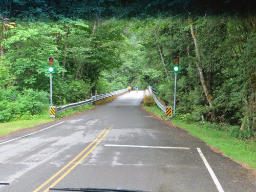
To enter the North Cascades National Park we had to drive over this one-way bridge with lights to direct traffic. Watch those bikers.
Very nice campground with quite a few large sites, well, large enough for our 35 footer. There is a nice mixture of tent, trailers, 5th wheels and motor homes. A quintessential dry camping campground - although, given the weather we’ve had recently, we prefer to call it a ‘wet’ campground. Note that Gary is wearing his raincoat. In fact, we’ve had them in the front seat of the car or the RV ever since we left California.
The North Cascades is really two stories: the story of this beautiful National Park which is almost an unknown park since it has so much wilderness.The names of its mountains range from Mt. Terror, Mt Dispair, Mt Torment, Desolation Peak to Mt. Challenger and Forbidden Peak while its other features boast such names as Devil’s Basin, Hell’s Basin and Deception Pass. Certainly not inviting and, in truth, even though it was designated as a National Park in 1968, until 1972 most travelers couldn’t even get here since there were only wagon tracks and trails for mules or pack horses. Oh, yeah, your snowshoes would work too.
It is also the story of the Skagit Project, in which JD Ross, the Superintendent of Seattle City Light, built 3 huge dams to provide to Seattle in the 1930’s, though both stories are intertwined.
The North Cascades are a beautiful mountain range in the northern part of Washington bordering on Canada. Often called the North American Alps, you can find mountain lakes, narrow canyons with steep, precipitous sides, rushing mountain streams, jagged mountain ranges, waterfalls of every size from tall to short and from wide to narrow and, above all, you can find more glaciers here than in any other place in the US. Because it is pretty far removed from most of the US, not as many people visit it as other National Parks but it deserves a view.
To get here you’ll travel along the only road through the park, Hwy 20, which, because of the rugged terrain, wasn’t built until 1972. Early attempts failed since when either the road was washed out or avalanches buried it. But, in the 1930’s, under the leadership of Superintendent Ross, the Gorge Dam and the Diablo Dam had been completed and the Ross Dam was in the works. Hundreds of people wanted to come to this area not only to see the dams and the source of their electricity, but also to explore the rugged wilderness that was here. Oops, a road was definitely needed and needed fast - let’s hire some lobbyists. And, the North Cascades Highway Assoc was formed with politicians and business owners from both sides of the mountain range.
Besides, the promise of tourist dollars, the lure of timber profits and the need for reliable transportation to and from the dams all convinced the politicians that a road was needed. It was not an easy task: the route was through narrow canyons next to the roaring Skagit River but it also went over and sometimes through the rugged mountains in its way. Cliffsides needed to be blasted away and the resulting rocks needed for roadbeds. Tunnels were dug. High mountain passes had to be climbed. But, finally in 1972, it was completed, a parade was held and hundreds of cars lined up to be the first over the road. Oh yeah, this road is closed for close to 5 months every year due to the snowfall. It usually closes somewhere around November 26 and usually opens up near April 21. I remember reading this year, as we were making our plans to travel over it, that it was finally opened. Whew.
Ok, we’ve got rugged beauty, a National Park and a road. Let’s get exploring. We first explored the hiking trails in the park. These circle through the park and out to the town of Newhalem, built in 1918 as a construction camp for workers on the Skagit Project. At times, over 300 people lived here and in Diablo, another town built for City Light employees. Fewer than 40 people live in the towns today though you can rent some of the homes and also the bunkhouses built to house tourists in the summer and project employees during the winter months. You can find homes, a community center, a gym, a store (where we found soda, coffee and cookies but which sells convenience items for those living in the area or in the nearby campgrounds).
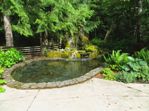
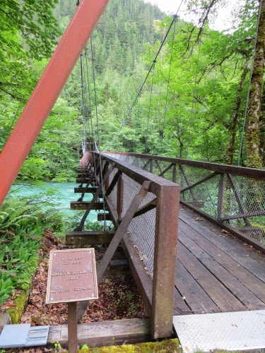
BUT, the best part is the Ladder Creek Falls Garden and waterfall complex. It’s lies over this suspension bridge,
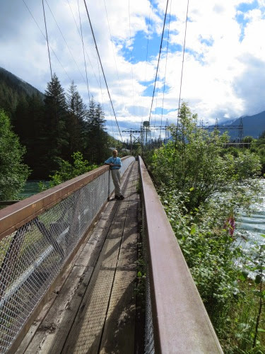
behind the power house and up the hill. Here Ross, ever the marketeer, built gardens, walking paths, steps
and bridges and pools to spotlight the waterfall in the 1930’s.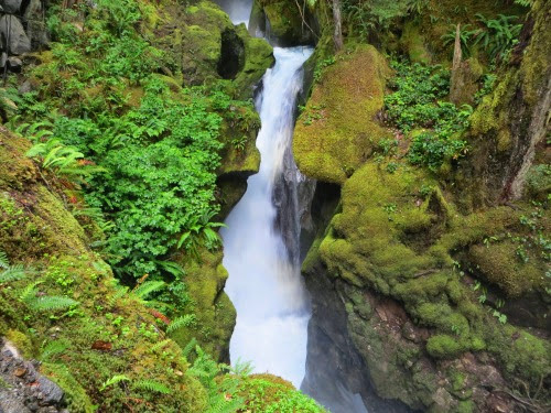
He wanted to dazzle people and show them the glories of electricity. Unfortunately the gardens, filled with exotic plants which needed to be housed inside during winter, did not survive the manpower shortages during WWII, but the paths, bridges and waterfall are still a delight.
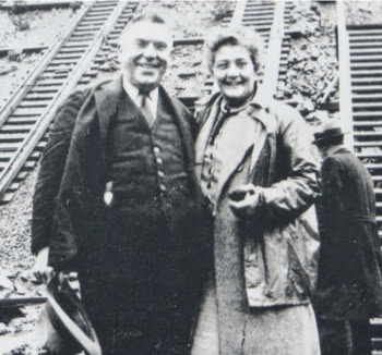
We then walked across the street where JD and his wife are interred in a crypt surrounded by the plants which he loved so much.
We then walked back to the campground, crossing this second suspension bridge with a sign on it saying ‘My Dad Built This Bridge’.
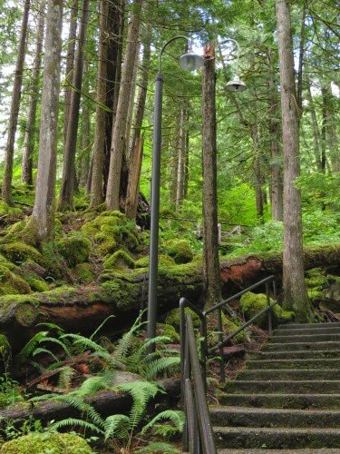
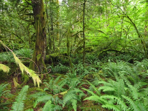
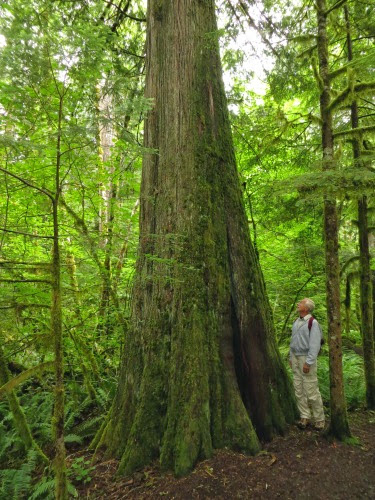
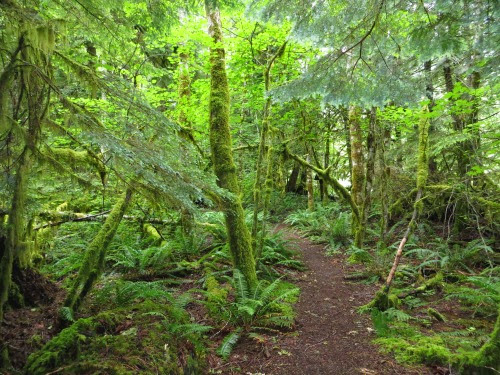
How cool is that? The trail goes through some old grow timber with towering Douglas Fir and Cedar trees back to the campground. Oh, yeah, it rained on and off the whole trip. But, being under these trees, we stayed relatively dry.
We also took a trail through the park and you can see how much rain this area has had over the last few weeks.
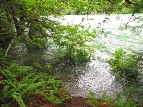
Not only was the water rushing along, it was overflowing its banks, in one case obliterating the trail. But the ferns covering the forest floor, the talk trees with moss covering their branches made us feel as if we were in a medieval forest. In a moment, the Ewoks will come dashing out between the trees.
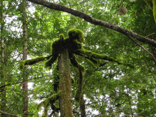
We thought this one looked like a spider at the top of the dead stump.
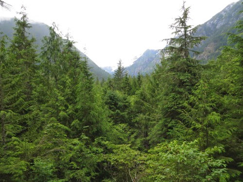
Neat trail through the rain forest of the North Cascades. At the end, at the Visitor Center, we were greeted with this view of the hike mountain ranges around us. Oops, it’s so cloudy and rainy that we couldn’t see the tops today.
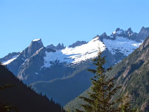
Here’s what they looked like several days later on a sunny day.
No comments:
Post a Comment