
Looks like a bit of sun will come our way today and we’re awake at 6:00 to take advantage of it. There is a 3-Cape tour from Tillamook south, taking you to see Cape Meares with its stubby lighthouse, Cape Lookout with its trail to the cliff’s end and Cape Kiwanda with its interesting rock formations. I had also printed out a description of some other things we could see along the way.
But first - we’re going to stop at the Tillamook Cheese Factory to tour, sample and learn about the cheese making process.
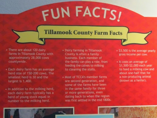
The land around Tillamook is perfect for raising cattle but, prior to the road building of the 1900’s, Tillamook was too far from any other population centers to ship milk and butter - it would spoil before it got there. So the Tillamook farmers began making cheese which could be transported much further without spoiling. The farmers banded together into a local cooperative and today there are 110 dairy farms varying from small herds of 30 cows to large herds of over 1400 cows. They make cheese: white cheddar, mild cheddar, sharp cheddar, cheddar with jalapenos, cheddar with pepper, Monterey Jack - as you can guess - it’s all about the cheddar.
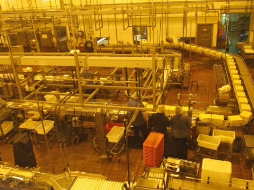
The factory itself is open for self-guided tours, you can read about the history of the factory and can view the cheese making process from large windows above. In this picture, you can see huge 40-lb blocks of cheese coming back from the aging room past the woman in the lower right who cuts them into 10-lb pieces then they slide down the conveyor belt to more cutters and finally the packaging.
You can also watch a video on the local farmers, read some fun facts,
sample their main cheese brands and, of course, shop in their store.
Very interesting self-guided tour and lots of information about the cheese making process and the history of the Factory.
I don’t know where to put this next little factoid but we read that many people were concerned about the dairy herds in Tillamook during the war. There were some who thought that if the Japanese invaded, they might take all the cows. So the plan was to walk the cows over the coastal range to safer territory. I’m still trying to wrap my head around thousands of cattle marching in a line over the mountains.
After we left the Tillamook Cheese Factory, we turned right on to the 3-Cape Route and the first thing we saw was that the road was closed 7 miles ahead. Great beginning. We stopped to ask a local homeowner about this and he told us that the road had washed out 3 years ago, they probably were not going to fix it and we needed to head the other way. So much for the 3-Cape route. So, instead of hitting the lighthouse from the north and heading south, we came up from the south, saw the lighthouse and then headed back south to finish the drive. Ok, that’s doable.
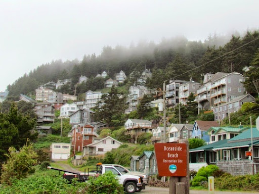
We got to a small town called Oceanside where the houses are built along the cliff in an amphitheater setting.
But the beach is nice and we found a ‘secret’ tunnel through the rock to the ‘secret’ beach on the other side. (As if everyone doesn’t know about this ‘secret’ tunnel and this beach. We saw at least 25 people taking the tunnel to the beach while we were there.)
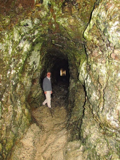
But it was fun, the beach on the other side was a beautiful sand beach but the rocks on the shore were otherworldly and covered with squawking birds. It’s nesting season and, I’m sure, they were chatting about the best square inch on the rock to nest.
Next was the 1890 Meares Point lighthouse - truly the shortest lighthouse I’ve ever seen. It stands only 38’ high but is on top of a 217’ cliff to make up for its own lack of height. It’s stubby and, as we walked up to it, I realized that it was lower than the sidewalk and I was looking right into the Fresnel light at the top of the lighthouse. Strange - and Gary stood on the sidewalk out side to take a picture of me in the top.
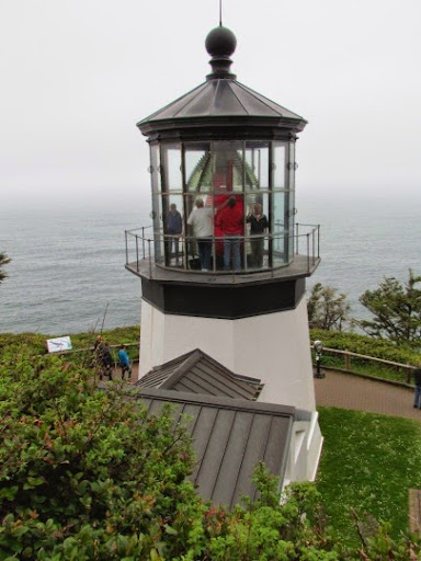
The Fresnel lens came from France, packed into a large crate, loaded onto a ship that sailed around Cape Horn and then up the coast to Cape Meares, a long trip. It is visible 21 miles out at sea. In 1934 electricity came to the lighthouse and lighthouse keepers were no longer needed when the Coast Guard installed an economical automated beacon.
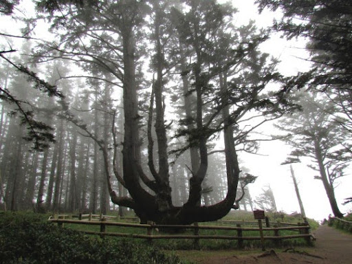
But here also was the Sitka spruce nicknamed the Octopus Tree, for an obvious trait. It is estimated to be 250 - 300 yrs old, is 10’ in diameter at its base and has no central trunk, just ponderous 3’ - 5’ in diameter limbs. Otherworldly in the fog and mist of an Oregon afternoon.
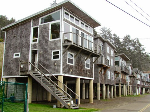
We stopped in a small village called Netarts where Happy Camp can be found. Here the homes are built on stilts for obvious reasons - being prepared for ‘high tide’ events. Most of these are rentals but a few are owner occupied.
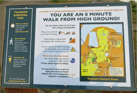
We continually see signs about escape routes for tsunamis. What to do and where to go. And, obviously, so close to the shore, you need to know where your escape route is since you’ve got only 5-8 minutes if the earthquake is nearby or 20+ minutes if it is further. Here’s a map for where we are and where we are to go if an earthquake hits.
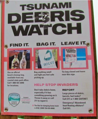
And, signs about what to do with any debris that you think might have washed in from a tsunami.
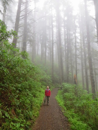
Our next stop on our 3 Cape Tour was the Lookout, a finger of land that sticks out into the ocean with a 2.5-mi trail to the tip. It was already raining when we arrived at the trailhead. But, at 3:30, we’re not going to see anyone else and have no where to go but home so who cares if we get a bit wet? We’ve got raincoats and, after all, it’s just rain. and, we’re not the only ones who thought this. We met several hikers coming off the trail (and popping the pop-tops of their icy cold beer from the cooler) and another hiker heading out onto the trail. Easy trail, with just enough ups and downs to start us huffing and puffing. The fog kept rolling in and the hid the forest beyond about 25’. We could hear the roar of the waves as they crashed up on shore many feet below but couldn’t see them at all.
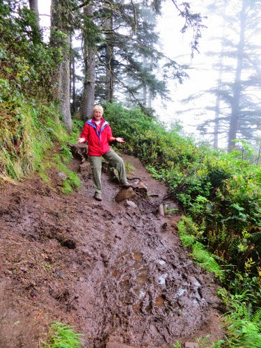
Since it had rained recently, the trail was still wet and there were some muddy sections with standing water that we had to jump, leap, log-walk or walk around.
Finally we hit the end of the trail, the fog cleared somewhat and the ocean came into view.
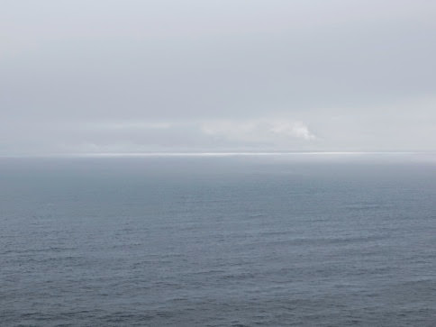
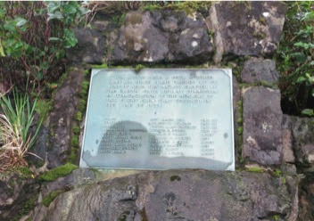
Here we rested and turned around. On the way back, we found the Crash Site Memorial where a B-17 bomber slammed into the headland in 1942. It was based in Pendleton, OR and was out on maneuvers when it was surrounded by fog, lost its bearings and plunged into Cape Lookout, cutting a swath through the headland 50’ wide and 500’ long. All but 1 of the 11 man crew was killed in the crash. There are no remains of the plane but this memorial marks the site.
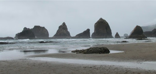
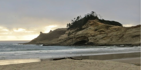
Finally we headed on down to the 3rd Cape, Kiwanda. It’s 6:00, its cold, its foggy and we’re hungry but Cape Kiwanda is so close that we might as well finish our journey. Unfortunately it was high tide and dark so we didn’t see much of the rocks which are very colorful and strangely shaped.
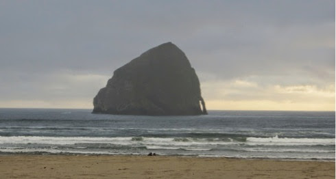
We also found Haystack Rock out in the harbor.
But, we did find a pizza parlor with a winning Portland Trailblazers game on.
Home about 9:00. Time for showers and bed. Fun day.
No comments:
Post a Comment