
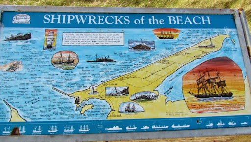
The ‘Bar’ where the Columbia River meets the Pacific is considered one of the most treacherous bars in the world to cross. The winds, the waves, the strong tides, the ever shifting sand bars, fog and the force with which a 1214-mile long river meets the largest ocean, all cause this area to be called the” Graveyard of the Pacific." Since 1825 when the British ship William and Ann sailed aground on Clatsop Beach and her 26 crew members were all lost, there have been approximately 114 vessels wrecked, stranded, sunk in collisions, or capsized in the Columbia River estuary, on the nearby beaches or at sea within a few miles of the entrance.
Often it was because the captains of these ships were not familiar with the vagaries of the Columbia bar and floundered where they shouldn’t have been. Sometimes it was bad luck. Often it was bad weather. Even experienced seamen can fall victim to the Columbia River. On May 4, 1880 a great sudden storm struck the river mouth and took the lives of 200 Columbia River fishermen alone. Shipwrecks like these prove that the Columbia River is truly the Graveyard of the Pacific.
In the past, experienced mariners sailed or steamed out beyond the bar and hired themselves out to those ships waiting offshore to enter the Columbia. Now it is regulated and there are both ‘bar pilots’, pilots who will board ships outside the bar and guide them inside and ‘river pilots’ who will guide the boats down the river. No ship can enter the Columbia without a pilot.
We have seen many maps detailing where these ships have sunk. Here is one of them but this one just shows the shipwrecks on the north shore of the Columbia River.
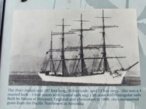
One of the ships which became a shipwreck in this area was the Peter Iredale, sunk in 1906 and now slowly deteriorating on the shore. It set sail from Great Britain in 1906 for the Columbia to pick up a load of wheat. The captain had offered his crew a bonus if they could cut 5 days off their sailing time. Good sailing weather allowed them to make good time but, and they drew near, the crew spotted Tillemook Head, just south of the entrance to the river. The captain wanted to wait until daylight to cross the bar but dense fog made navigation difficult and he was 50 miles closer to shore than he thought he was. By the time he realized this, it was too late, the Iredale floundered on a sand bar where it sunk. No one died and they were able to offload the goods but the ship remained where it had sunk, slowly rotting away. It is now a tourist attraction and a monument to poor navigation.
It began looking like this.
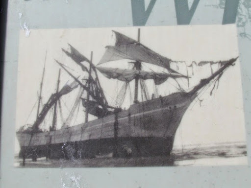
When it ran aground, it looked like this.
Now, after many years on the beach, it now looks like this.
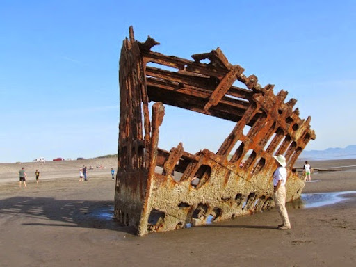
All those dark things sticking up out of the sand are part of the ship’s keel and sides. If you look closely and connect the dots, you can almost see the outline of the ship in the sand.
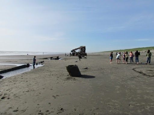
This wreck is clearly marked on maps of Fort Stevens State Park and we found the parking lot almost full. It is, in truth, a beautiful beach, it was a marvelously sunny day and Oregonians, used to rain and clouds, flocked to the beach.
Down the coast from the Peter Iredale is Fort Stevens, named for Territorial governor General Isaac Stevens who was killed in Chantilly, VA in 1862. Here there are fortifications dating from the Civil War to WWII all designed to protect not only the shoreline but also the shipping lanes to the interior. America was actually attacked by a Japanese submarine which got close enough to the shore to lob 17 shells towards Fort Stevens on the night of June 21, 1942. Most fell harmlessly, on a nearby baseball field and in a swamp but one landed near Battery Russell and another next to a concrete pillbox. The batteries located the submarine and were ready to fire but were told to hold their fire. The commander had ordered a complete blackout after the first few shots. There are several speculations as to way, possibly he didn’t want to reveal their position to what he considered not a real threat, possibly the sub was beyond the reach of their guns or possibly because there was a conflict between the state artillery and the federal commanders.
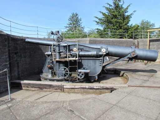
Here’s one of the battery guns in its lowered position so it could be loaded. To fire, its was raised.
And, here’s the back of the battery itself, The front of the battery faced out towards the Pacific Ocean. Note that the front is pretty well covered by the hillock they built to camouflaged it.
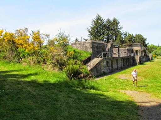
This was the only wartime action of Fort Stevens. When the army coast artillery abandoned Fort Stevens, the guns and armament were removed but the batteries, the concrete placements for the guns, remain as do many other landmarks. These are the main attraction in the fort now. We toured the batteries, the museum and what remained of the other buildings in the area.
No comments:
Post a Comment