
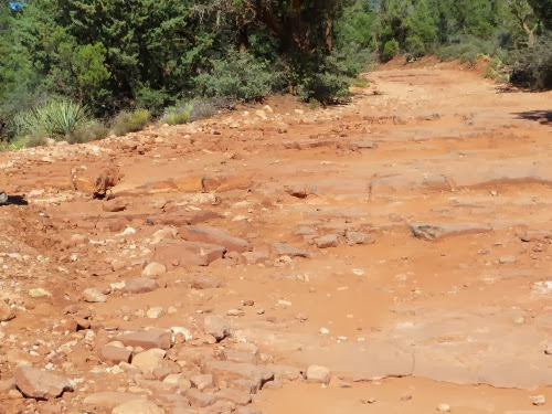
Our goal today was to drive up to Vultee Arch on FR 152 (Forest Road 152), hike to the arch, drive back down FR 152 to the Devil’s Bridge, the largest natural sandstone arch in the Sedona area, hike to that and then drive home. Knowing that these two hikes are fairly short, I also had hopes of driving over to Fay Canyon and hike that also. Right, as if we might get all this done. Luckily I hadn’t told Gary what my ‘real’ plans were. But it didn’t matter since we took the turn-off for FR 152, drove 50’ and - there it was - a real ‘natural materials’ road. Actually, we think the first few boulders were placed in strategic spots to discourage people from driving on this road.
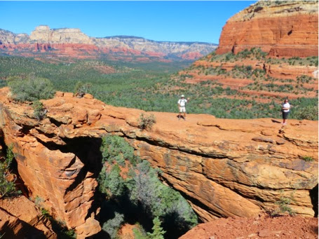
We drove the road for about 1/2 mile then decided to park our Jeep along the road and walk the road as have many others judging by the boot prints we were following. When we got to the trailhead for the Devil’s Bridge we turned in, just as 3 young women from Michigan were turning in also. We enjoyed talking with them as we all hiked to the top. Since this is a popular hike, it was a conga line up to the Bridge itself as many others had the same idea we did. As we were climbing up, others, who had gotten there earlier, were climbing down. Finally we reached the top and saw about 30 others scrambling around. As is usual in this kind of situation, everyone was polite, waiting for others to get their pictures taken before walking out on the bridge itself for their picture.
Here’s Gary out on the Bridge. Me, I’m just the photographer.
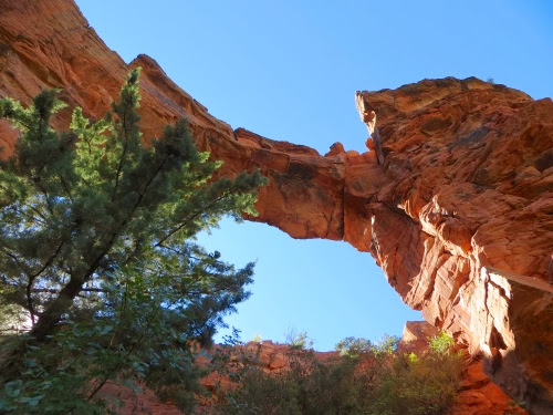
We then climbed to a spot under the arch for another view.
Finally, we hiked back down the trail, turned right up the road and began to hike towards Vultee Arch. If we didn’t want to drive to it, we thought we’d hike. We were passed by several Pink Jeeps and several what I called ‘doodlebugs’ since they were small ATV’s. After about 3 miles, we checked our GPS and realized that we were still only 1/2 was to Vultee Arch. Hmmm. Time for lunch while we mull this over.
Nope, we decided that we were not going to make it all the way to Vultee Arch today, turned back and followed a forest trail back to our car. No more of that road bit.
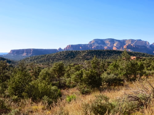
We also had a great view of Bear Mountain and all of its various levels where we had hiked several days ago. Doe Mountain, another popular hike is the shorter mesa to the left . We began in the trailhead which is between Doe and Bear and headed up to the highest point on Bear Mountain.
Actually, all the trails in this area are new in the last 2 years, compliments of the Red Rock Rangers. Wanting more trails they took a large parcel and carved out about 4 new trails. When we got back to the car, we headed over to the trailhead to see the map for these new trails, parked and saw this group of artists as we headed over to the map. Looks like artists congregate in popular spots just like hikers.
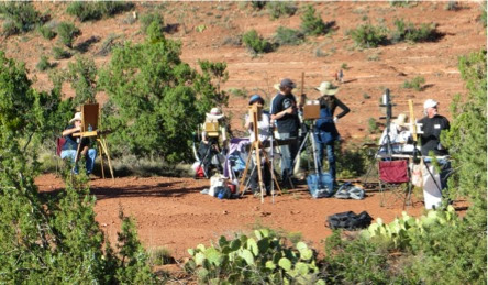
At the map we met a couple who had gotten married in this area 2 years ago. But, since then the area has all been changed: new trails, new trailhead, new parking lot. They were having trouble finding where they had actually said their vows but thought it was right about where the artists were.
6.81 1330’
No comments:
Post a Comment