
We drove from Moab, UT to Blanding, UT yesterday, a long drive of 72 miles. We checked in, set up and then headed over to the Visitor Center which was not only stocked with lots of pamphlets about things to do in this area, books about the history and the geologic and natural phenomenon but also had a fine museum about the founding and growth of Blanding. We also picked up some ideas for exploring the area.
And, today we follow the Anasazi, some of the original inhabitants of this area. We had done some online research, found some easily accessible ruins and some hikes to others. We especially wanted to see the House of Fire, an Anasazi ruin, and the best time to see it was in the morning when the sun came over the cliffs, but before it hit the actual ruins. Which meant an early morning since it was a long drive and a long hike into it. Somehow setting the alarm for 6 AM sounds like a great idea at 10 PM when we do it, but when the alarm goes off, loses its appeal really fast.
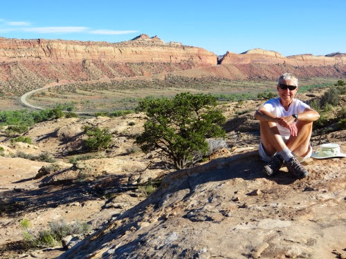
Generally, when we hike, we don’t see many others on the way and we can enjoy the solitude and the sounds of nature. Today was not to be one of those hikes: as we pulled into the trailhead, there were 3 large 8-people vans with several other cars parked higgledy-piggledy around the spot. I guess they hadn’t expected anyone else there. But, we found a spot to park, geared up and followed the crowd out.
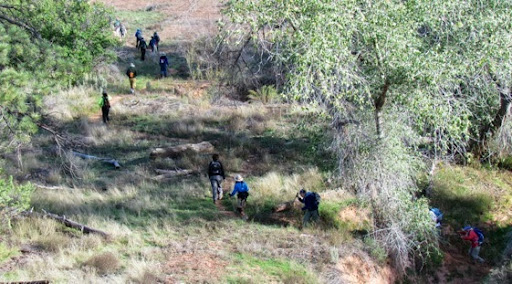
We held back a bit both so we didn’t infringe upon them and also could feel as if we were alone with the ancient people who lived in this area and trod the ground we were treading.
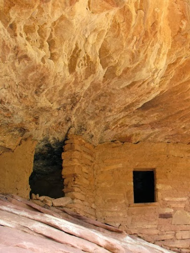
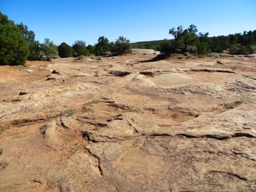
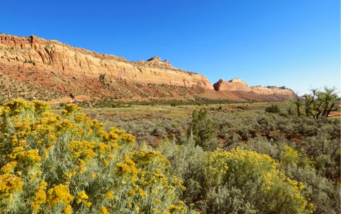
Beautiful trail, through lots of greenery, along the creek which drained the cliffs around. We could easily understand why the Anasazi chose this area for their homes. A water source with abundant plants and herbs useful for food and medicine, cliffs with caves for homes and security, rock for building these homes and a beautiful view out the living room window. The ruins are about 800 years old and have not been restored in any way. There were about 7 ruins along this trail and we planned to see what we could.
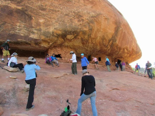
If we hadn’t known exactly where the House of Fire was, we quickly learned, we just followed the excited chatter from the group of 33. They were on a side path, up a small cliff waiting for the right hour for their pictures. If I had hoped to get a picture with no humans in it, I was going to have to click fast when no one was near. However, as the prescribed time for the best shot arrived, everyone cleared out so that we all could get a good shot. We enjoyed talking with these hikers. They were 2 hiking groups from Sacramento, spending 2 weeks in southern Utah visiting the National Parks.
Luckily, they had gotten into Arches NP before the government shutdown and already had planned this trip to Blanding. They were not sure where they might go next since the National Parks are closed but thought that Monument Valley was a distinct possibility. It’s amazing how many people in this area are scrambling now to find things to do to fill their itinerary with the National Parks closed. There are a lot of alternative things to do as we are finding, but the National Parks were the big draw.
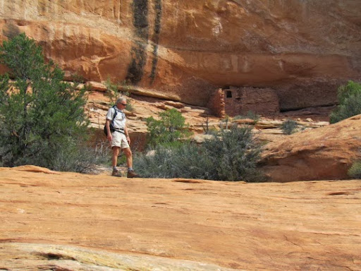
At the prescribed time, the House of Fire, in the aura of the rising sun, looked as if it was on fire, so striking were the colors in the rocks above. Sometimes, they were yellow, sometimes red and other times, they glowed orange.

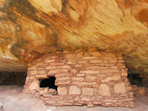
We stayed around after the group left, enjoying the quiet and solitude and imagining life as the Anasazi lived it. We then wended our way down the trail, always on the lookout for other ruins. Of course, we looked to the north side of the valley since the Anasazi built their homes to capture the sun for warmth. But, because the area was overgrown and the ruins were fairly high up the rock cliffs, it was difficult to spot where they might have built. We did spot several and enjoyed scrambling up the cliffs towards them, trying to imagine how the original owners of these homes might have climbed up to them without vibram soles on their hiking boots.
We then turned back because we had other things to see.
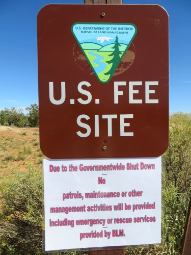
This is a BLM site and we saw this sign as we were leaving and paying our fee.
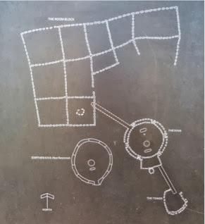
Our next stop was the Anasazi ruin which actually had a rest stop, some coverings over the ruins and probably had been stabilized. This site consisted of a 2-story watch tower of which only part of the first story remains, a kiva and an L-shaped housing unit. All were connected by a tunnel. Here is a diagram of the site.
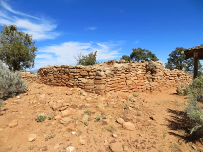
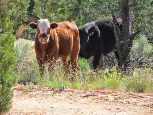
The watchtower was in line with other watchtowers, one of which was our next stop. We pulled in, opened the gate which kept the cattle in, drove down the road and found - sure enough, the 3 8-person vans and various cars of the 33 Sacramento hikers, higgledy-piggeldy parked in the parking area. They must not have expected anyone else to want to park here. We all waved and talked, surprised to see each other again. But they were leaving and we walked into the site. We walked across this ‘road’ and you can see the tire tracks of vehicles which did indeed use this as a road. Not my kind of road but others did use it since about 1/2 mile in we found a truck beside a tent all set up for camping.
We also found some other hikers as we were meandering along. No wonder there was a fence.
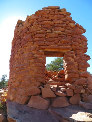
The site was filled with several towers. I caught this one as the sun was gleaming through it. Each stone was aglow with the sun’s rays as if translucent.
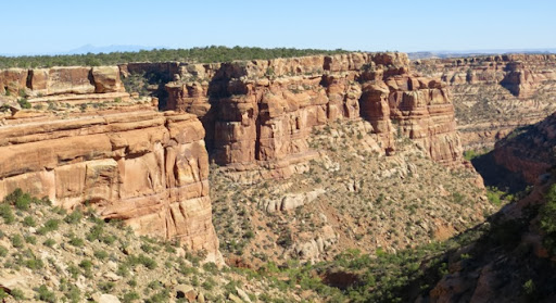
We could also see several cliff-side homes hidden away in the layers of the canyon wall. Again, we could see why they chose this valley as a home: close water source, overhanging layers under which to build a home for security and a great view from the living room window.
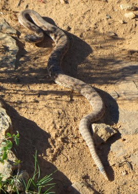
We scrambled around getting pictures and admiring the expert masonry of the towers but finally had to leave. We took different routes out and, as I was working my way across the rocks, trying not to step on the cryptobiotic soil, I heard the tell-tale sound of a rattlesnake. Now I have never heard this sound before but I knew what that hollow rattle sound signified: a near-by rattle snake. Oops. I jumped, as it were, over the snake just as it slithered under me, both afraid of the other, luckily. I then turned and tried to get a picture of it slithering away - until it turned towards me. That was it for my picture taking. It was about 3’ long but was enough to hurry me along the path away from it.
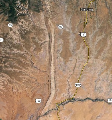
Back to the car and, as we had had a long day, we turned home to the RV. We had to cross what is the ‘Comb’ to get back to Blanding. This is a 100-mile long, and 1-mile wide escarpment of stone rising high above the valley below. It runs from north to south on the west side of Blanding. From the air, it looks like this on this satellite image from Google.
From our car, it looked like this looking south:
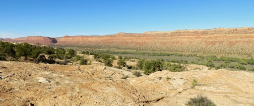
and like this looking north.
Here you can see the opening they cut in the cliff for the road to go through.
It must have been a formidable barrier to the Mormons who had already crossed almost impenetrable barriers to get to this point. Did it deter them? Absolutely not, they cut their way through this rock as they had cut their way through other layers of rock in their journey from Salt Lake City to Bluff, UT. But that is another story, one for our trip to Bluff on Friday.
7.5, 1300’
No comments:
Post a Comment