
How many of you have ever heard of Great Basin National Park? Precious few, I’m sure. I hadn’t heard of it until I was looking at my map of the National Parks and wondering how we could get to all of them. I saw that we could visit this one on our way back to Des Moines and put it on the schedule. Actually, here’s a bit of geography. This park, on the central eastern border of Nevada, takes its name from the Great Basin which is an area from the Wasatch Mountains in NE Utah to the Sierra Nevadas in California and from southern Oregon to southern Nevada. Within this area, no rivers flow out to the Pacific, the Atlantic or the Gulf. They all flow inward, into the Great Basin. It was first discovered and named by John C. Fremont in the mid 1800’s, though how he discovered this, I don’t know. Actually, there are 90 basins within this Great Basin and the rivers of each these basins flow into the center of each basin.
The Great Basin National Park has been a National Park since 1986. Within it is the southernmost glacier in the US and some of the world’s oldest trees, the Bristlecone Pine. This park, like all other National Parks is open all year. However, the snow lasts so long here that the ‘season’ usually begins in June when the uppermost 8 miles of Wheeler Scenic Drive are open. This year there was so little snow that the park has been busy since Easter.
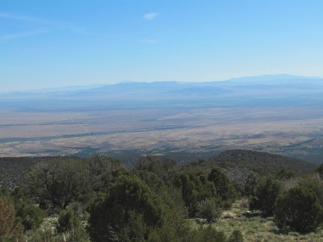
Probably the most fascinating thing about the park is its Alpine nature in the midst of a desert. You can be down where we are camping and see scrub brush and sand, and know that you are in a desert. Drive a few miles up into the park and you’re surrounded by a pine forest so thick and so deep that you could get lost in it
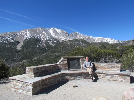
If you’ve read this blog before you know how much I like hiking in the snow. And, today we got to do that - and more. At 8:45 we picked up Ray and Twyla who were camping in the NP campground for the 11-mile drive up to Wheeler Peak campground at 10,000’. It is a twisting, winding road which gains elevation pretty fast. We read that the road and the view are both breathtaking. And, judging by all the stops at all the turnouts we took, we 4 would agree. At times we were looking up at Jeff Davis Peak on the left and and Mt. Wheeler on the right.
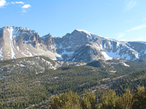
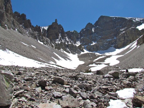
(Before I go on, I want you to take a close look at this picture which I took from the road heading down the mountains after the hike. Notice the curve on the right with the snow in the center? We thought that was the glacier that we were heading for on the trail and we headed that way. However, note the higher mountain with the snow in shadow at its base, in back of that curve. That’s where the glacier actually is and where we were supposed to hike. I wish we had seen this before we headed out. )
At other times we were looking out over the valley below us.
Awesome views.
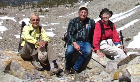
At the top, at 10,000’ we got ready and headed for the trail. And, as you can see from our pictures, we are all over Medicare age and all kitted out for hiking in the snow. Ray and Twyla have been hiking for years. They went down and up the Grand Canyon in a day with their kids quite a few years ago. in 2009, just 3 years ago, they hiked up to the base camp of Everest. They took 19 days, hiked 146 miles and reached a maximum elevation of 18,456’. They traveled with a guide but stayed in inns and ate in small restaurants along the way. They carried their clothing, a bedroll, toiletries and a few other things (like a heavy winter coat) in those large packs. I sure hoped that they would not outclass us on the trail. This hike has to be a mere walk in the woods for them.
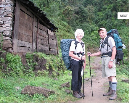
Here’s a picture that I stole from their website showing them at the beginning of their Everest hike. It obviously got much colder as they approached the base camp and in the second picture are Twyla and Ray at the base camp, in another picture that I stole.
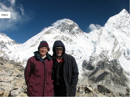
What adventurers these two are.
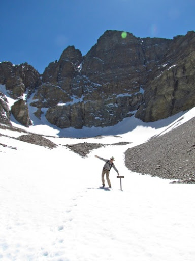
Now, back to our hike: the snow was pretty deep here, at times at least 2’ deep, and obscured the trail. We knew that the Rangers discouraged hiking until the snow had melted so that hikers could see the trails but we have only this one time here and we headed out. The first 20 feet were fine and well marked. But then the snow began to cover the trail. We saw footprints ahead of us and followed them but we knew that these people were as clueless as we were and didn’t know where the trail was either.
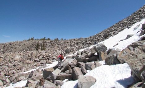
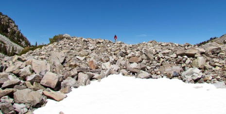
Since we knew we were heading for the glacier, we looked to the right, and dead reckoned that it was over that way and off we went. It was a treacherous climb since most of it was a huge rock field. Some rocks were large enough to scramble over and others small enough to walk on. All of them were irregularly jumbled and just waiting for an errant ankle. Not a fun place to be. But, we kept on, always scanning ahead looking for any glimpse of a trail. But, there was none to be seen.
Finally, we all came to the conclusion that we were in the wrong canyon and that we had to go up and over that rocky ridge to our left to get into the right canyon to see the pines and the glacier. More rocks but we were careful and, at the top of the ridge, we saw an obvious trail a ways away in a small valley. Whew.
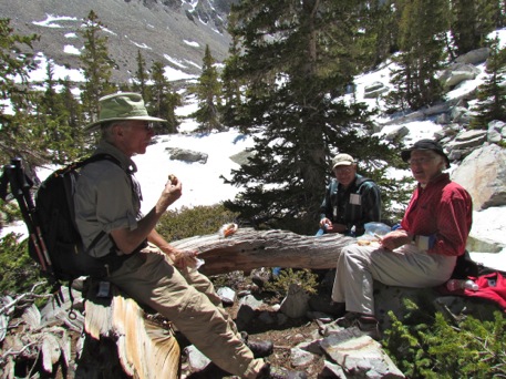
We scrambled and bushwhacked to the trail and - voila - there were the Bristlecone Pines. What a sight. We enjoyed them for a bit but we pressed on to the glacier, planning to see them more closely on the way back. We did take time to eat lunch in the Grove and what a good lunch it was. Usually, Gary and I hike in the desert and take peanut butter and jelly sandwiches so they will not spoil. Here it is colder and Twyla had packed ham and cheese sandwiches, apricots, carrot sticks and gorp. I had brought some protein bars and cheese. We sat in the sun and enjoyed the day.
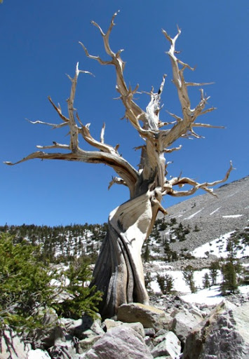
Then we began the final haul up to the glacier. And, wouldn’t you know it, we got lost right away as we left the Bristlecone Grove. Oh, my. But this time we could see the glacier ahead of us and we plodded on. Because the rocks were so treacherous, we tended to stick to the snowpack but that was not always easy. Often our feet would post hole a foot or two into the snow and we’d lose our balance a bit. Gary wandered ahead, found the trail and we finally walked through the rocks on an actual trail. And, that is the glacier in the shadow of Mt. Wheeler.
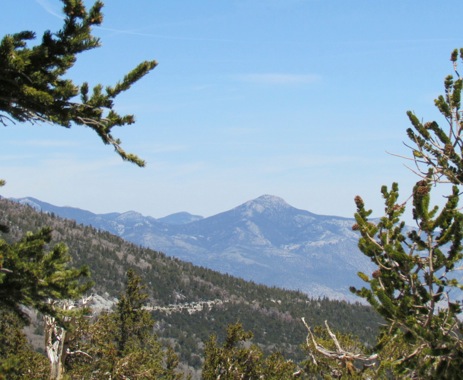
But, whatever the difficult of trail finding, it was a marvelous day and the views were awesome. The sky was so blue, the jagged peaks were outlined against the sky and the snow glistening in the sun. We were sometimes lost, parts of the trail were treacherous but we were all enjoying the hike. What magnificent views surrounded us. And, the temperatures were probably in the 60’s.
We kept plugging on and approached the glacier. Finally we were at the end of the trail and we just sat there to enjoy our journey.
The atmosphere was so crystal clear here that we could see every crag on the peaks.
However much we were enjoying the day, it was time to head back. Luckily it is easier to see the trail when you are heading down the trail than when you are heading up and we walked the trail for most of the way to the Bristlecone Grove.
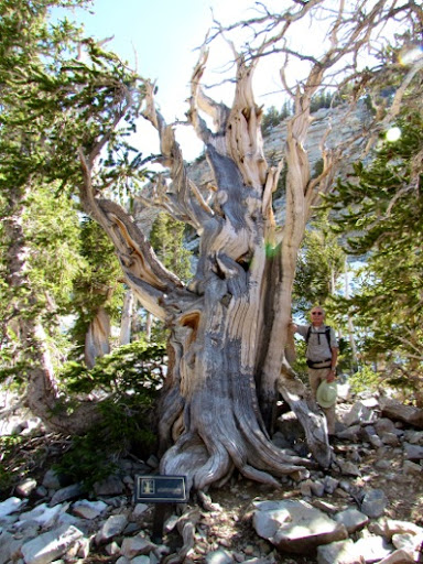
Here are some of the magnificent Bristlecones.These trees live between 9500 and 110,00 feet and endure the harsh climate at that level, the winds, the snow, the cold and the ice. They have developed to withstand the extremes on the mountains, they twist to be stronger against the wind and they grow short with a massive trunk. Here is a tree that started in 1230 BC, and is 3200 years old. Much of it looks dead but there is living growth on the left hand side.
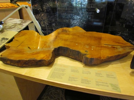
And, you want to know how they date a living tree. Well, that was my question too. Actually, they 'cross date'. Trees which grow at the same times and close to each other have the same size rings so, they match a dead tree with a living one to determine its age. Have you ever heard of cutting a tree down to determine its age? A tree called Prometheus which was 4900 yrs old was cut down for research purposes. I don’t know who cut it down but what were they thinking? And, here is a slice from it which we found in the VC.
Look at the needles on this branch. They grow in 5’s and can live for 40 years. Look how thick they are on the branch compared to the evergreens you see in your back yard. The more needles, the better the water retention in a harsh climate.

The trees have such high resin content that they do not rot and can remain whole for years even after they have died.
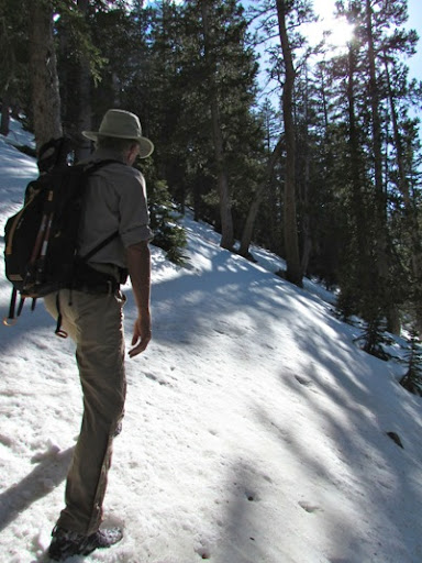
And, finally, we’re on our way back down to the car. But, as we round a curve and hit the forested shady side of the mountain the snow got deeper and the trail was covered. Since it is on a mountain side, the snow slopes over the trail and we have to dig our heels in to that we don’t slide down the slope. Here Gary is on the trail but you can’t see any footprints ahead of him.
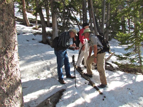
Do these 3 people, looking at the GPS, know where they are? Nope. Ray tells us that we are 560 yards from the car and it’s over that way. What the GPS doesn’t know is that those 560 yards are filled with trees, steep hillsides, 1’ - 2’ deep snow and fallen logs and branches waiting to turn an ankle. But, at least we know the direction and the distance and we all take off in the general direction of the car.
Then, in the middle of the woods, we saw someone coming up the hill towards us, he was obviously not on any trail the park has. He was dressed in shorts, t-shirt, sneakers and had no water. And, he was heading off up the trail at 4:30 in the afternoon. 5 minutes later, we saw another young man, dressed the same way, trudging through the snow but at least he was not heading up the trail. It looks like he was just puttering around. My, the naivety of youth.
As you know, we all made it back safely (or you wouldn’t be reading this blog) We took them back to their RV and headed back to ours, tired but so happy that we had made the hike with them. What serendipity that 2 people we just happened to meet in Eureka a few days ago also like to hike and were coming to the same NP that we were.
No comments:
Post a Comment