
Well, I guess we’ve been sitting around long enough and it’s time to venture out to see Sunset Crater and an Ancestral Puebloan village called Wupatki. Both are on the NE outskirts of Flagstaff and about 20 minutes from our campground.
Sunset Crater is actually a volcano which erupted sometime between 1080 - 1150 AD. When it erupted, it probably rumbled for days beforehand, warning the Sinaqua, the indigenous people who farmed in this area, who abandoned this area and moved further afield, into the Wuparki area to the north.
Soon after the turnoff to the National Monument, you are driving through a grassy field dotted with pine trees. At this time of year the grass is a beautiful golden and about 2’ long. It’s a glorious drive on a sunny day. Then you spy the lava field. From afar and close up, it looks like big chunks of black dirt just turned over by the plow. That’s my Iowa background showing through. Actually, the big chunks are hard brittle chunks of black lava. This lava field is about 20 feet high and, from our view level with the field, it was difficult to tell how wide it was. Very difficult to hike in but across the road was a huge ash heap which looked like a tall hill.
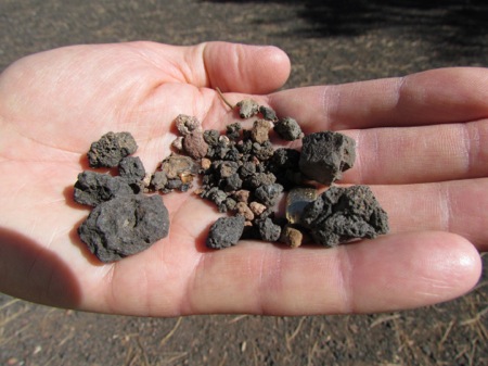
This we could climb but it was like climbing a sand dune, 2’ forward, 1’ slippage. the askes and cinders were small, irregularly shaped and slippery. And, the trail didn’t have many switchbacks: someone thought they’d wear us out on the first hill and designed a vertical trail. Here’s Gary holding a handful of what we were walking on. Imagine trying to ascend a 100 yd hill on this stuff.
But, the view of the San Francisco Peaks from the top was stupendous. Here we met a couple who also RV and spend their winters in the Alabama panhandle on the Gulf of Mexico. (They were out here for a family reunion in Tucson and, when they get home, they’ll pack up and leave for Alabama.) Sounded nice and we’ll look into it for next year.
Sunset Crater is just a bit further along the road. Climbing it used to be allowed but, because it is ash cinders like Gary is holding above, the trail kept widening and widening until it was changing the slope of the crater itself. Finally, they closed the trail in 1973, shoveled the ashes back to where they started to prevent further erosion and put in a loop trail below the Crater. This enables you to walk in the actual lava field.
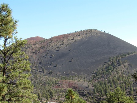
If you look closely at the black ash on the right hand side of the crater you can see the shadows of the former trail.
Since the top of the mountain has a reddish cast, John Wesley Powell, who was the first explorer in this region, named it Sunset Crater.
Then on to Wupatki, after a short picnic lunch on an overlook from which we could see the Painted Desert, hazy in the distance.
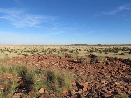
Wupatki is actually a group of 800 identified ruins spread out around the deserts around the current site of the monument. Many of the ruins we have seen recently have been much larger groupings. In this case the groupings are smaller but there are more of them. The Monument road takes you by about 6 of these and you can hike out to them for a closer look from parking lots at each of these. Sometimes you can see other groupings off in the distance.
They are all made out of the reddish Moenkapi stone prevalent in the area. They were made by the Sinaqua during the 1100’s and 1200’s who moved her from their original farms near the Sunset volcano when its eruption made that land infertile. As happened throughout this area, the people abandoned their villages in the 1300’s and headed south.
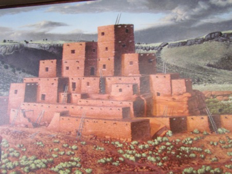
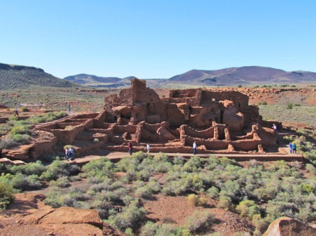
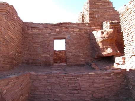
The largest of the buildings is Wupatki (Hopi for ‘big house’) which probably held 300 people and was 3 stories. Here’s what it probably looked like in is heyday and here is what it looks like now. It’s pretty impressive.
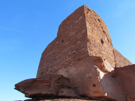
Next we visited the Wuloki ruins which consists of a large tower built on a high ridge of sandstone.
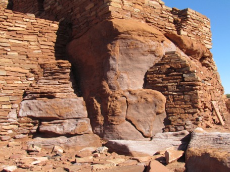
We also visited several other of the ruins, always impressed with the skill with which they were built, their size and how they incorporated the stone they found into their buildings. Note the square edges and the large boulders incorporated into the design.
Great examples of the building, farming and organizational skills of these early peoples. How they could grow enough crops to feed themselves on this rocky desert land is amazing.
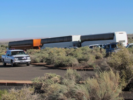
As we were leaving the Visitor Center, here’s what drove up and disgorged about 90 junior high kids. Looks like our timing was perfect.
Then home.
No comments:
Post a Comment